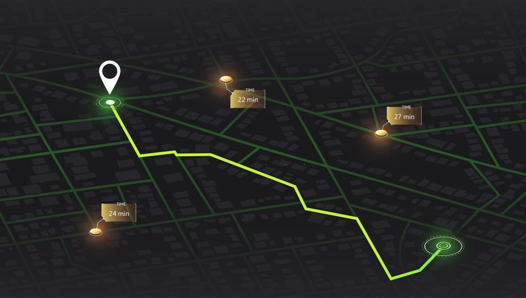
Map that allows users to explore and interact with geographic or location-based data
Interactive Map
interactive map architecture typically involves combining various technologies and components to build a map that allows users to explore and interact with geographic or location-based data. Below is an overview of the architecture for creating an interactive map.
Interactive maps offer numerous benefits across various industries and applications due to their ability to engage users and convey information effectively. Here are some of the key benefits of interactive maps
Benefits of  Interactive Map
Enhanced User Engagement
Interactive maps provide an engaging user experience, allowing users to explore and interact with geographic data, locations, and points of interest.
Data Visualization
They are effective tools for visualizing complex data sets, making it easier to understand patterns, trends, and relationships in the data.
Geospatial Context
Interactive maps provide geospatial context, helping users understand the location and distribution of information, which is crucial for decision-making.
Real-Time Updates
Interactive maps can display real-time data, making them valuable for applications that require up-to-the-minute information, such as weather, traffic, or asset tracking.
Navigation and Wayfinding
Interactive maps assist users in finding their way, whether it’s for directions, tourism, or locating nearby services and businesses.
Tourism and Travel
They assist travelers in planning trips, finding attractions, and exploring destinations with detailed maps and information.